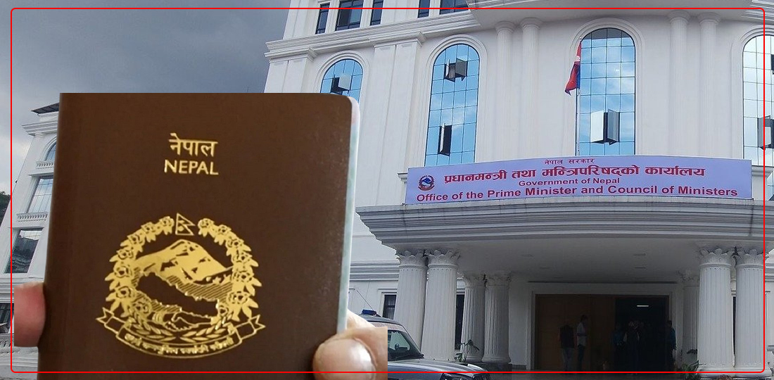
HUMLA: A paradise of nature and culture
Humla - the second-largest district of Nepal - is brimming with incredible natural beauty and ecological abundance, along with rich cultural diversity. It is among the rarest places that have preserved ancient Himalayan traditions, culture, and practices. It lies in the far north-west part of Karnali Province adjoining the Purang county of Ngari prefecture of Tibet Autonomous Region (TAR), China on north. Simikot is Humla's district headquarter, and the word Simikot comprises two words; Sim and Kot, where Sim means wetland, and Kot means a fort.
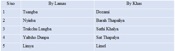
People living in the north and south part of Humla maintain many differences in culture and practices. The lower southern parts of Humla are primarily inhabited by Khas, Dalit, Thakuri, and Chhetri (Thar). They are identified as the followers of Shaman-based Hinduism, and they also follow the Hindu caste system. These people are called Topitale by people living in the upper part of Humla. The higher northern reaches of Humla are home to several Tibetan Shaman-based Buddhist and Tibetan-speaking communities. These include Bhot/Bhote and Byansi, which are also called Thapaliya in the Khasa language. The Bhote communities of Humla are categorized under the following five categories:
Both Topitale and Thapaliya communities share a complex relationship, hierarchy, reciprocity, co-existence, and contestations. However, they share an affinity for the sanctity of Mount Kailash and Lake Manasarovar— even if this sanctity manifests in different ways.
There are both tangible and intangible cultural ties between the people of northern Humla and TAR, China. Many monasteries in Tibet were demolished during the Cultural Revolution, and many monks took refuge in the south and established replica-monasteries in different parts of Nepal and India. Tibetan Buddhist monasteries in Humla have some association with the monasteries in Tibet, especially in Khojarnath, Taklakot, Rakshas Tal, and Gyangdrak. The culture and traditional practices of the ancient Khas kingdom, Zhang Zhung kingdom, and Tibetan culture are still preserved in the original form in Humla. The Cultural Revolution of China massively affected the traditional Tibetan culture in Tibet. Besides, modernization has further fueled the deterioration of conventional practices, but such ancient traditions are still preserved in Humla. Songs that are sung during festivals in Tibet are still practiced in their original form in Humla.
Similarly, the traditional furniture and Chinese brocade are still found in their original form in Humla. The pre-Buddhist Bon religion and Nyingma(pa) school of Tibetan Buddhism are still wholly practiced in Humla. Similarly, the polyandry marriage system is still in existence in the Bhote Lama ethnic community of Humla. Thus, Humla can be seen as a living cultural museum, found neither in the Tibetan plateau nor in the Indian plain.
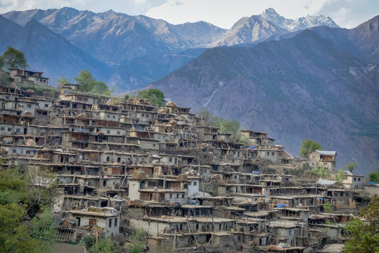
Traditionally, the Khasa Hindu Humli communities were involved in subsistence agriculture, localized pastoralism, and the trade of Tibetan merchandise (such as salt, borax, pashmina, and wool) with mid-hill communities - Accham, Doti, Bajhang, and Bajura. The Buddhist Humli communities were more involved in the trade with Tibetans at various seasonal trade marts located both in Humla and in western TAR, China. The Buddhist Humli communities also carry-on migratory pastoralism, and still, few families continue the practice, but at an insignificant level. There is a unique housing pattern in rural Humla. The houses are built of muds, and it is flat-roofed, where the roof of one house becomes the front yard of the other house. The traditional attire of the Humli people varies from Northern to southern parts. Northern Humlis wear similar clothes as Tibetans, whereas the southern residents have some similarities with Hindus.
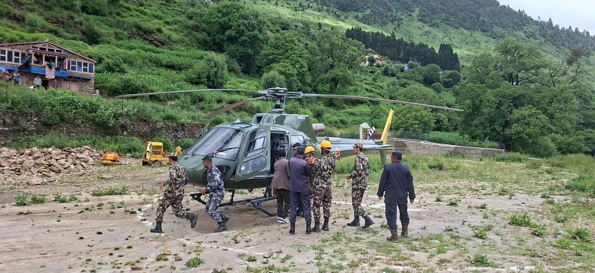
Humla is the only isolated district that is not yet connected to the national road network of Nepal, although it is already connected to Tibet via both the Limi-Lapcha and Hilsa border by road. The Nepal Army is constructing Karnali Corridor to the south of Simikot which is planned to connect with Humla. Humla has a domestic airport in Simikot, and it is the only easy and direct means to reach Humla. Simikot airport is located at 2,818 meters above sea level, and the length of the runway is 549 meters. It is a short take-off and landing (STOL) airfield; thus, the airport can handle only small aircraft and helicopters. The other option to reach Simikot, Humla, is to walk for three-five days from the adjoining districts. The prices of essential commodities are high as all goods are either first airlifted to Simikot or need to come from Tibet's border town, carried by humans or mules to reach the household. In rural parts of Humla, sheep, goats, and mules are used as the most common transportation mode, bringing daily consumables from the road-based temporary nearby market or from the district headquarter to the rural parts of Humla.
Humla is among the best gateways to Mount Kailash from Nepal, but it is not commercially famous due to a lack of road infrastructure. Since time immemorial, both Hindu and Buddhist religions have been going on a pilgrimage tour to the Kailash region, especially to Lake Manasarovar and Mount Kailash. The Kodari (Zhangmu in Chinese) border between Nepal and China was severely damaged by the earthquakes of April 25, 2015, and May 12, 2015. It did significant damage to the physical infrastructure and caused the loss of many human lives. As a result, the border was closed entirely. The border was not only the leading trade and transit border between Nepal and China, but it was also the most widely used border by the pilgrims to go to Mount Kailash. Thus, not only the import and export of goods got stopped at this border, but also the route to Mount Kailash via Kodari was shut down. Only after this, the Hilsa route via Simikot, Humla, was brought back to meaningful use for the Mount Kailash pilgrimage, and it is quite a popular route now. Travel agencies in Kathmandu estimate that more than 10,000 Indian pilgrims entered Purang County of Tibet, China, via Humla in 2016.
Humla is a hidden treasure of the Himalayas with immense and unexplored natural and cultural diversities. The natural beauty includes towering green cliffs, cascading waterfalls, swift rivers, and mesmerizing landscapes. Humla is extensively rich in various natural resources, and among them, forest products, including herbs and water resources, are the major. There are different types of trees; coniferous, hardwood, mixed trees, and shrublands, due to climatic variations. There are also many kinds of valuable herbs, although their medicinal values are yet to be explored. The rivers and rivulets in Humla and the Karnali region have enormous potential for hydropower development and water-induced industry, and such resources have been almost not utilized yet. Humla has enormous potential to be promoted as a tourist destination for several purposes, including trekking, cultural tours, glacier expedition, and academic research on anthropology, geology, and other disciplines. Humla was opened to tourists in the 1990s by the government of Nepal. However, even after two decades, Humla is significantly less visible on Nepal's tourism map. Humla still remains under a restricted area where the free-flow of tourists is not allowed. Tourists are required to get a specific permit to visit. Thus, although many low-budget tourists would like to see Humla, they can't afford it due to the requirement of permits and expensive flight tickets.
Despite being blessed with immense natural and cultural diversity, Humla is one of Nepal's poorest and least developed districts. Life in the Himalayan region is very hard for people seeking material wellbeing. These places remained untouched by the modern world for many years due to a lack of necessary infrastructures like transportation and communication, and still, the situation has not significantly improved.